High-Performance Computing for High-Value Weather Forecast
Currently, aeronautical meteorological information is focused on giving the meteorological conditions at the departure and arrival airports. Due to their size and flying dynamics, Unmanned Aerial Vehicles (UAVs, so-called ‘drones’) flights will be much more vulnerable to icing and adverse wind flight conditions. HERCULES profect focused on the development of much specific and detailed information to avoid blocking economic activity linked to the 'professional use of drones' and future Urban Air Mobility.
SECTOR: Transport
TECHNOLOGY USED: HPC
COUNTRY: Spain
The challenge
Currently, aeronautical meteorological information is focused on providing the meteorological conditions at departure and arrival airports. Although this is sufficient for conventional aviation, it is not enough for Unmanned Aerial Vehicles (UAVs, so-called ‘drones’). Due to their size and flying dynamics, drones are more vulnerable to their surroundings. Hence, one of the main factors to be considered in the operational safety of drones is accurate and reliable weather forecasting throughout the flight path. This is difficult to achieve mainly due to two factors:
- Drones do not start or finish their missions from fixed points such as airports and thus cannot rely on fixed ground infrastructure, which leads to a lack of real-time meteorological data for specific locations.
- The airworthiness characteristics of drones make them more sensitive to adverse weather such as icing or strong winds.
It should also be considered that predictions of future drone use state that most future flights will be out of sight of the pilot (BVLOS flights) and autonomous, thereby being unable to rely on human operators for correcting the planned trajectory in adverse weather situations. It is therefore clear that a reliable weather forecast specifically suited to drones is needed to sustain the desired growth that the European authorities envisage for the sector.
Aslogic focussed on addressing this challenge by providing drone operators with services to increase the safety level of the planned missions and their flights but faced technological issues. Namely, the computational capacity required to verify meteorological predictions over a large area at high resolution exceeded that of the most powerful servers used by the SME or ULE. In order to test if a prediction could be made for a whole region/country and if an update could be given on an hourly basis, an HPC system was necessary.
The solution
The HERCULES experiment addressed the challenge of creating reliable weather forecasts appropriate for drones without expensive ground equipment by focusing on the following 3 components:
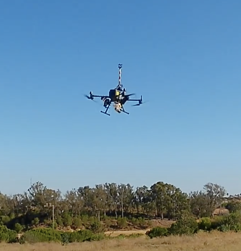
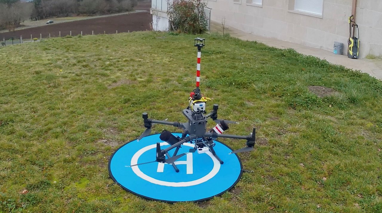
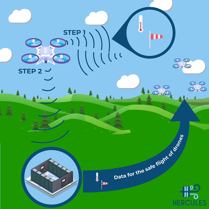
- The use of Meteodrone: An Unmanned Aerial Vehicle that characterizes atmospheric conditions (temperature, wind speed, pressure, dew point temperature) thanks to a set of onboard sensors. The drone used for this characterization was quite robust, compared with other commercial small drones, thereby ensuring that the drone itself did not suffer from bad weather conditions. This Meteodrone collected weather information during 150 flights over key locations in Galicia to provide the necessary data for the building of the forecast models in the next step.
- The implementation of 4 different parametrized Weather Research and Forecasting (WRF) models to provide accurate weather prediction in the region of Galicia with a horizontal resolution of 3 km at different altitudes (10, 20, 50 and 125 meters). The use of HPC resources shortened the execution time for weather model parametrization and reduced the development time of the weather service.
- The provision of tools and services through the newly developed HERCULES website where customers define the area in which the flights will be executed and recover the relevant weather information report for their missions.
Business, Social and Environmental Impact
HERCULES’ solution will enable the creation of safe and efficient drone operations by providing operators the capability to obtain dedicated weather forecasts at their flying altitudes without relying on expensive ground infrastructure (an estimated savings of €100,000). This service will be one of the keys to unlocking an emerging sector that is expected to grow by €10 billion annually until 2035. In addition, the live information provided by the Meteodrone (a UAV with a set of onboard sensors to collect weather data) could be used to support traditional manned aviation during landing procedures in aerodromes that cannot use ground infrastructure for weather predictions.
Aslogic estimates that with a pricing policy based on an annual subscription (€30/€60 for premium services) HERCULES could reach 2,000 pilots/users in the next 3 years with a turnover of €78,000 per year.
At the same time, the HERCULES high-resolution local weather forecast models have the potential for future business opportunities in other industries – for example, wind energy or fishing in which accurate weather prediction could positively impact safety and efficiency.
- High-resolution weather forecast without relying on ground infrastructure (saving €100,000) and providing capabilities to characterize atmospheric conditions at any location.
- A weather forecast optimised for Unmanned Aerial Vehicles that can increase operational efficiency and safety thanks to the collection of weather forecast information at low altitudes (10, 20, 50 and 125 meters) and with high horizontal resolution. This will unlock an emerging industry that is expected to grow €10 billion annually until 2035.
- With a pricing policy based on an annual subscription (€30/€60 for premium services) HERCULES could reach 2,000 pilots/users in the next 3 years with an expected turnover of €78,000 per year for Aslogic.
Organisations involved:
End User: Aslogic 2011
HPC Provider: CESGA
Domain Expert: Universidad de León
Partner CESGA is part of the NCC Spain.